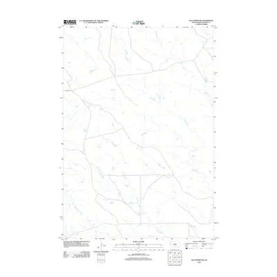
2012 Map of Volunteer NW
USGS Topo · Published 2012About this map
Old Hwy 212 cuts across this prairie landscape of Butte County, tracing a historic transportation route through the western South Dakota plains. The drainage pattern here is defined by several seasonal waterways, including the meandering paths of Eightmile Creek and Fourmile Creek. These creeks are characteristic of the high plains drainage system, showing the intricate network of draws that feed into the larger Cheyenne River basin. Irrigation infrastructure, such as the Willow Creek Lateral, reflects the region's managed water resources, essential for ranching and agriculture in this semi-arid environment. Further east, Mud Elm Creek and Station Elm Creek highlight the local naming conventions that often tied water sources to the few trees or designated landmarks found in the open territory.
Find a feature on this map
6 named features on this map. Tap any name to fly to it.
Don’t see what you’re looking for? This feature index may not catch every label — zoom into the map to look around manually.
Map Details
Editions of this 2012 Volunteer NW Map
This is the sole edition of this map. No revisions or reprints were ever made.
Other maps of this area

1906 · Vale
USGS Topo · 1:62,500

1913 · Newell
USGS Topo · 1:125,000

1951 · Volunteer
USGS Topo · 1:24,000

1951 · Volunteer SE
USGS Topo · 1:24,000

1951 · Vale SE
USGS Topo · 1:24,000

1951 · Vale NE
USGS Topo · 1:24,000

1951 · Vale
USGS Topo · 1:62,500

1953 · Rapid City
USGS Topo · 1:250,000

1957 · Rapid City
USGS Topo · 1:250,000
1959 · Volunteer NW
USGS Topo · 1:24,000