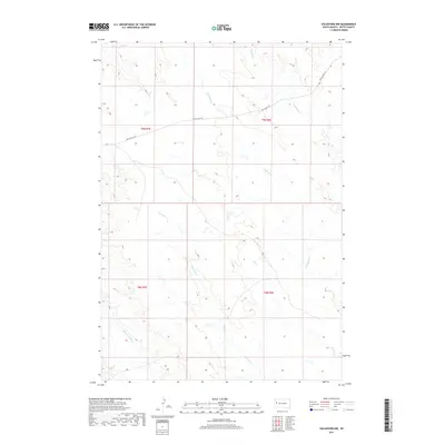
2017 Map of Volunteer NW
USGS Topo · Published 2017About this map
Eightmile Creek and Fourmile Creek carve a series of intermittent drainage patterns across this Butte County landscape, which is defined by its open range and legacy of public land surveying. This area of South Dakota, mapped during the 2010s, exhibits a sparse network of watercourses and a single major transportation corridor, the Old US Hwy 212. The presence of the Willow Creek Lateral in the southwest suggests a landscape managed for irrigation or water diversion, common in the high plains. Spanning several townships including t9n r7e and t8n r8e, the terrain is dominated by natural contours rather than dense settlement, offering a clear view of the underlying topography and the relationship between early highway routes and the natural creek beds.
Find a feature on this map
9 named features on this map. Tap any name to fly to it.
Don’t see what you’re looking for? This feature index may not catch every label — zoom into the map to look around manually.
Map Details
Editions of this 2017 Volunteer NW Map
This is the sole edition of this map. No revisions or reprints were ever made.
Other maps of this area

1906 · Vale
USGS Topo · 1:62,500

1913 · Newell
USGS Topo · 1:125,000

1951 · Volunteer
USGS Topo · 1:24,000

1951 · Volunteer SE
USGS Topo · 1:24,000

1951 · Vale SE
USGS Topo · 1:24,000

1951 · Vale NE
USGS Topo · 1:24,000

1951 · Vale
USGS Topo · 1:62,500

1953 · Rapid City
USGS Topo · 1:250,000

1957 · Rapid City
USGS Topo · 1:250,000
1959 · Volunteer NW
USGS Topo · 1:24,000