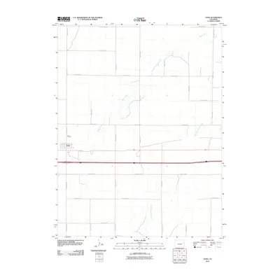
2010 Map of Vona
USGS Topo · Published 2010About this map
Vona stands as a small agricultural hub on the high plains of Eastern Colorado, centered around the intersection of the railway and modern highways. The settlement's street grid is clearly defined just north of the major transportation corridor, with the Vona Cemetery located slightly to the northwest, providing a point of reference for local genealogical research. This landscape is characterized by its organized section-line road system, including County Road AA and County Road S, which partition the territory into large agricultural blocks.
Find a feature on this map
20 named features on this map. Tap any name to fly to it.
Don’t see what you’re looking for? This feature index may not catch every label — zoom into the map to look around manually.
Map Details
Editions of this 2010 Vona Map
This is the sole edition of this map. No revisions or reprints were ever made.
Other maps of this area

1954 · Limon
USGS Topo · 1:250,000

1957 · Limon
USGS Topo · 1:250,000

1958 · Limon
USGS Topo · 1:250,000

1969 · Alpine Ranch NE
USGS Topo · 1:24,000

1969 · Tuttle
USGS Topo · 1:24,000

1969 · Stratton
USGS Topo · 1:24,000

1979 · Vona
USGS Topo · 1:24,000

1979 · Seibert NE
USGS Topo · 1:24,000
1979 · Alpine Ranch NW
USGS Topo · 1:24,000

1979 · Stratton 3 NE
USGS Topo · 1:24,000