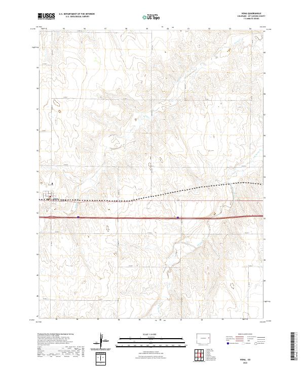
2022 Map of Vona
USGS Topo · Published 2022About this map
Vona sits at the heart of this High Plains landscape, situated along a primary transportation corridor in Kit Carson County. The settlement pattern is defined by a rigid section-line road network, including Co RD W and Co RD U, which carve the prairie into precise agricultural blocks. To the northwest of the town center lies the Vona Cem, a focal point for local genealogical research. The terrain is subtly shaped by the drainage systems of Spring Cr and its tributary, the E Br Spring Cr, which meander through the townships of t8s r48w and t9s r47w. This survey captures the intersection of modern infrastructure and the enduring PLSS grid that has governed the region since its early settlement.
Find a feature on this map
16 named features on this map. Tap any name to fly to it.
Don’t see what you’re looking for? This feature index may not catch every label — zoom into the map to look around manually.
Map Details
Editions of this 2022 Vona Map
This is the sole edition of this map. No revisions or reprints were ever made.
Other maps of this area

1954 · Limon
USGS Topo · 1:250,000

1957 · Limon
USGS Topo · 1:250,000

1958 · Limon
USGS Topo · 1:250,000

1969 · Alpine Ranch NE
USGS Topo · 1:24,000

1969 · Tuttle
USGS Topo · 1:24,000

1969 · Stratton
USGS Topo · 1:24,000

1979 · Vona
USGS Topo · 1:24,000

1979 · Seibert NE
USGS Topo · 1:24,000
1979 · Alpine Ranch NW
USGS Topo · 1:24,000

1979 · Stratton 3 NE
USGS Topo · 1:24,000