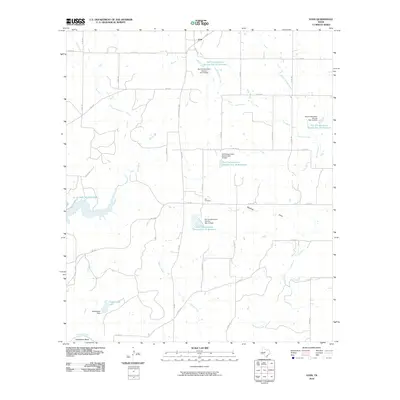
2010 Map of Voss
USGS Topo · Published 2010About this map
Voss and the surrounding ranchlands of Coleman County are defined by a sophisticated network of water management, evidenced by the numerous Soil Conservation Service reservoirs and dams that dot the landscape. The northern portion of the O. H. Ivie Reservoir pushes into the western edge of the quadrangle, while the Colorado River marks the southern boundary at the prominent Horesshoe Bend. The terrain is etched by seasonal watercourses like Rawhide Draw and Elm Creek, which feed into larger arteries such as Panther Creek and Mercer Creek. Local history is anchored by the presence of Hill Cemetery and established ranch infrastructure including the Featherston Dam and its namesake Featherston Lake. The road network, including the Ray Stoker Jr Hwy and various farm-to-market roads, illustrates the connectivity of this rural Texas community at the start of the 21st century.
Find a feature on this map
42 named features on this map. Tap any name to fly to it.
Don’t see what you’re looking for? This feature index may not catch every label — zoom into the map to look around manually.
Map Details
Editions of this 2010 Voss Map
This is the sole edition of this map. No revisions or reprints were ever made.
Other maps of this area

1887 · Coleman
USGS Topo · 1:125,000

1889 · Coleman
USGS Topo · 1:125,000

1892 · Eden
USGS Topo · 1:125,000

1892 · Ballinger
USGS Topo · 1:125,000

1894 · Brady
USGS Topo · 1:125,000

1896 · Eden
USGS Topo · 1:125,000

1924 · Eden 1-a
USGS Topo · 1:48,000

1925 · Brady 2-b
USGS Topo · 1:48,000

1925 · Ballinger 4-c
USGS Topo · 1:48,000

1928 · Waldrip
USGS Topo · 1:62,500