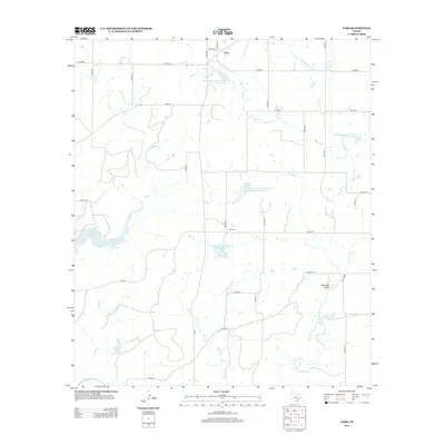
2013 Map of Voss
USGS Topo · Published 2013About this map
Voss occupies a high-plains landscape in Coleman County, defined by a network of drainage systems and modern water management. The Colorado River skirts the southwestern corner, while major tributaries like Mercer Cr and Panther Cr cut through the terrain. A series of federal land-management features, including the Soil Conservation Service Site 12 Reservoir and several numbered sister sites, illustrate the region's mid-to-late 20th-century focus on soil stabilization and flood control. Near the center of the sheet, the Hill Cem sits as a quiet historical marker among the rural roads. The western edge is dominated by the expansive O. H. Ivie Reservoir, showing how this portion of the Texas interior was reshaped by large-scale water projects that transformed the original creek beds into significant reservoirs.
Find a feature on this map
39 named features on this map. Tap any name to fly to it.
Don’t see what you’re looking for? This feature index may not catch every label — zoom into the map to look around manually.
Map Details
Editions of this 2013 Voss Map
This is the sole edition of this map. No revisions or reprints were ever made.
Other maps of this area

1887 · Coleman
USGS Topo · 1:125,000

1889 · Coleman
USGS Topo · 1:125,000

1892 · Eden
USGS Topo · 1:125,000

1892 · Ballinger
USGS Topo · 1:125,000

1894 · Brady
USGS Topo · 1:125,000

1896 · Eden
USGS Topo · 1:125,000

1924 · Eden 1-a
USGS Topo · 1:48,000

1925 · Brady 2-b
USGS Topo · 1:48,000

1925 · Ballinger 4-c
USGS Topo · 1:48,000

1928 · Waldrip
USGS Topo · 1:62,500