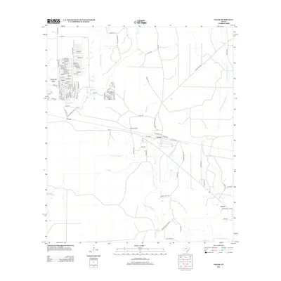
2013 Map of Votaw
USGS Topo · Published 2013About this map
Votaw and its neighboring communities are defined by a complex drainage system of southern Texas creeks and bayous. The landscape is dominated by the meandering course of Pine Island Bayou and Menard Cr, which flow through a region of dense local road networks. The curiously named settlement of Hoop and Holler sits in the northwest corner, characterized by a series of residential streets like Beechnut and Chincapin, while Fuqua and Thicket serve as other primary nodes in the area. The presence of Wild Cow Marsh suggests the low-lying, often saturated nature of the terrain that influences the placement of these settlements. Transportation follows historical corridors such as the Logging Road B, reflecting the area's industrial ties to timber and land management within Hardin County.
Find a feature on this map
105 named features on this map. Tap any name to fly to it.
Don’t see what you’re looking for? This feature index may not catch every label — zoom into the map to look around manually.
Map Details
Editions of this 2013 Votaw Map
This is the sole edition of this map. No revisions or reprints were ever made.
Other maps of this area

1943 · Liberty
USGS Topo · 1:125,000

1954 · Beaumont
USGS Topo · 1:250,000

1955 · Saratoga
USGS Topo · 1:62,500

1955 · Rayburn
USGS Topo · 1:62,500

1957 · Beaumont
USGS Topo · 1:250,000

1958 · Livingston
USGS Topo · 1:62,500

1958 · Segno
USGS Topo · 1:62,500

1984 · Segno
USGS Topo · 1:24,000

1984 · Beaumont
USGS Topo · 1:250,000

1984 · Jacks Creek South
USGS Topo · 1:24,000