
1955 Map of Rayburn
USGS Topo · Published 1957About this map
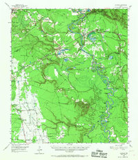
The Trinity River winds through a dense network of oxbows and backwater lakes including Sevenmile Bend and Hanners Bend, illustrating the shifting hydrology of this East Texas bottomland. To the west, Tarkington Prairie emerges as a distinct agricultural and social landscape, characterized by a concentration of small country churches and rural landmarks. This mid-century survey documents the transition between the river lowlands and the higher prairie ground, featuring notable sites like the Tarkington Prairie Sch (Historical Ruins) and the Oak Shade Cem. The Gulf Colorado and Santa Fe RR cuts across the northern terrain, connecting rail-dependent settlements like Milvid and Romayor. This era shows a community anchored by places of worship such as Hi-Way Tabernacle and Magnolia Grove Ch, providing essential geographic context for family historians researching the Liberty County area.
Find a feature on this map
82 named features on this map. Tap any name to fly to it.
Don’t see what you’re looking for? This feature index may not catch every label — zoom into the map to look around manually.
Map Details
Editions of this 1955 Rayburn Map
2 editions found
Other maps of this area

1943 · Liberty
USGS Topo · 1:125,000

1954 · Beaumont
USGS Topo · 1:250,000

1955 · Daisetta
USGS Topo · 1:62,500

1955 · Saratoga
USGS Topo · 1:62,500

1955 · Liberty
USGS Topo · 1:62,500

1957 · Beaumont
USGS Topo · 1:250,000

1958 · Cleveland
USGS Topo · 1:24,000

1958 · Westcott
USGS Topo · 1:24,000

1958 · Livingston
USGS Topo · 1:62,500

1958 · Segno
USGS Topo · 1:62,500