
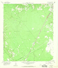
1958 Map of Westcott
USGS Topo · Published 1959About this map
Sam Houston National Forest dominates the northern reaches of this East Texas survey, where the heavy timber of the Piney Woods meets the open grasslands of Tarkington Prairie. The landscape is defined by the winding course of Tarkington Bayou and the East Fork San Jacinto River, which create a complex drainage network for the surrounding timberlands. Settlement is concentrated along the transport corridors, particularly near the rail junction at Shepherd and the small siding at Napier. Local history is preserved in several rural congregation sites and burial grounds, including Big Creek Missionary Ch and Lovett Cem. The Southern Pacific railroad and the Texas And New Orleans line provide the primary infrastructure, reflecting the region's reliance on rail for moving timber and agricultural products toward the Gulf Coast during the late 1950s.
Find a feature on this map
27 named features on this map. Tap any name to fly to it.
Don’t see what you’re looking for? This feature index may not catch every label — zoom into the map to look around manually.
Map Details
Editions of this 1958 Westcott Map
Other maps of this area

1943 · Liberty
USGS Topo · 1:125,000

1954 · Beaumont
USGS Topo · 1:250,000

1955 · Rayburn
USGS Topo · 1:62,500

1957 · Beaumont
USGS Topo · 1:250,000

1958 · Fostoria
USGS Topo · 1:24,000

1958 · Cleveland
USGS Topo · 1:24,000

1958 · Livingston
USGS Topo · 1:62,500

1958 · Bear Creek
USGS Topo · 1:24,000

1960 · Camilla
USGS Topo · 1:24,000

1960 · Coldspring
USGS Topo · 1:24,000