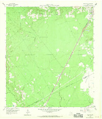
1958 Map of Westcott
USGS Topo · Published 1970About this map
Sam Houston National Forest dominates this topographic record of East Texas, where the dense woodlands of the Piney Woods meet the open spaces of the Prairie in the southeast. The landscape is defined by the winding paths of Tarkington Bayou and the East Fork San Jacinto River, which create a complex drainage system through the timberlands. Cultural life in the late 1950s centered on crossroads communities and small religious centers like Big Creek Missionary Ch and New Hope Ch.
Find a feature on this map
31 named features on this map. Tap any name to fly to it.
Don’t see what you’re looking for? This feature index may not catch every label — zoom into the map to look around manually.
Map Details
Editions of this 1958 Westcott Map
Other maps of this area

1943 · Liberty
USGS Topo · 1:125,000

1954 · Beaumont
USGS Topo · 1:250,000

1955 · Rayburn
USGS Topo · 1:62,500

1957 · Beaumont
USGS Topo · 1:250,000

1958 · Fostoria
USGS Topo · 1:24,000

1958 · Cleveland
USGS Topo · 1:24,000

1958 · Westcott
USGS Topo · 1:24,000

1958 · Livingston
USGS Topo · 1:62,500

1958 · Bear Creek
USGS Topo · 1:24,000

1960 · Camilla
USGS Topo · 1:24,000