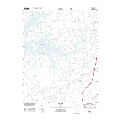
2011 Map of Vox
USGS Topo · Published 2011About this map
Laurel River Lake dominates this 2011 landscape, its irregular shoreline reaching deep into the drainage basins of Indian Camp Creek, Rogers Creek, and Frozen Camp Creek. The area north of the lake is punctuated by the settlement of Vox, while the community of Grove and its associated Grove Recreation Area sit to the west. This map illustrates the transition from the recreational lakeside environment to the agricultural and residential corridors along the southern boundary, where developments like Southwood Ests have emerged.
Find a feature on this map
51 named features on this map. Tap any name to fly to it.
Don’t see what you’re looking for? This feature index may not catch every label — zoom into the map to look around manually.
Map Details
Editions of this 2011 Vox Map
This is the sole edition of this map. No revisions or reprints were ever made.
Other maps of this area

1890 · Williamsburg
USGS Topo · 1:125,000

1893 · London
USGS Topo · 1:125,000

1894 · Williamsburg
USGS Topo · 1:125,000

1897 · London
USGS Topo · 1:125,000

1952 · Corbin
USGS Topo · 1:24,000

1952 · Wofford
USGS Topo · 1:24,000

1952 · Lily
USGS Topo · 1:24,000

1952 · London SW
USGS Topo · 1:24,000

1952 · Vox
USGS Topo · 1:24,000

1952 · Ano
USGS Topo · 1:24,000