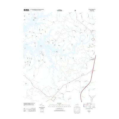
2013 Map of Vox
USGS Topo · Published 2013About this map
Laurel River Lake dominates the landscape west of the Daniel Boone National Forest, its branching fingers reaching into the hilly terrain of the Cumberland Plateau. This 2013 survey illustrates a region defined by recreational access and rural community hubs, where White Oak Campground and the Grove Recreation Area provide modern leisure facilities alongside long-standing local landmarks. Smaller settlements like Vox and Scuffletown are connected by a network of winding roads, many of which still carry the names of early educational and religious centers. Evidence of the area's development is found in the traces of old infrastructure, such as Oak Grove School Rd and Tye Town School Rd, and the presence of the Corbin Speedway near the southern edge of the quadrangle. The hydrology is intricate, with Conoe Cr and Whippoorwill Cr feeding into the larger river system, while several family-named burial grounds like McFarland Cem provide vital links for local genealogical research.
Find a feature on this map
77 named features on this map. Tap any name to fly to it.
Don’t see what you’re looking for? This feature index may not catch every label — zoom into the map to look around manually.
Map Details
Editions of this 2013 Vox Map
This is the sole edition of this map. No revisions or reprints were ever made.
Other maps of this area

1890 · Williamsburg
USGS Topo · 1:125,000

1893 · London
USGS Topo · 1:125,000

1894 · Williamsburg
USGS Topo · 1:125,000

1897 · London
USGS Topo · 1:125,000

1952 · Corbin
USGS Topo · 1:24,000

1952 · Wofford
USGS Topo · 1:24,000

1952 · Lily
USGS Topo · 1:24,000

1952 · London SW
USGS Topo · 1:24,000

1952 · Vox
USGS Topo · 1:24,000

1952 · Ano
USGS Topo · 1:24,000