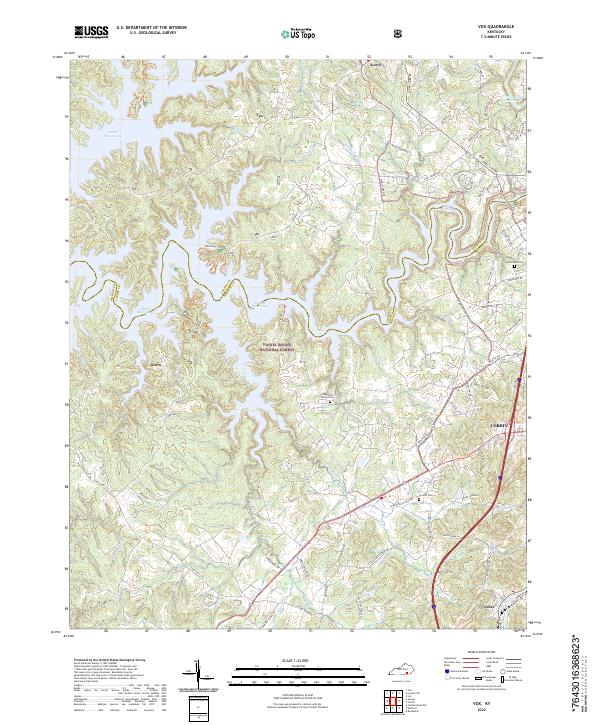
2022 Map of Vox
USGS Topo · Published 2022About this map
Corbin serves as a regional anchor on this map, showing the city's western edge where residential streets meet the dense woodlands of the Daniel Boone National Forest. The landscape is dominated by the intricate, branching arms of Laurel River Lake, which fills the deep valleys of Rogers Cr and Indian Camp Cr. This geography creates a series of isolated peninsulas where small communities like Vox, Grove, and Keavy are situated along ridge-top roads. For those tracing family history, several burial grounds are documented, including Chestnut Grove Cem and Corinth Cem. The transition from the urban interface of the city to the protected forest land is clear, with the Corbin City Reservoir and various creeks like Canoe Cr and Little Spruce Cr carving through the plateau.
Find a feature on this map
72 named features on this map. Tap any name to fly to it.
Don’t see what you’re looking for? This feature index may not catch every label — zoom into the map to look around manually.
Map Details
Editions of this 2022 Vox Map
This is the sole edition of this map. No revisions or reprints were ever made.
Other maps of this area

1890 · Williamsburg
USGS Topo · 1:125,000

1893 · London
USGS Topo · 1:125,000

1894 · Williamsburg
USGS Topo · 1:125,000

1897 · London
USGS Topo · 1:125,000

1952 · Corbin
USGS Topo · 1:24,000

1952 · Wofford
USGS Topo · 1:24,000

1952 · Lily
USGS Topo · 1:24,000

1952 · London SW
USGS Topo · 1:24,000

1952 · Vox
USGS Topo · 1:24,000

1952 · Ano
USGS Topo · 1:24,000