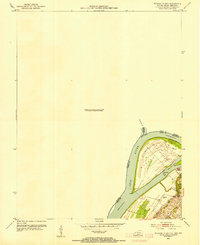
1953 Map of Wabash Island
USGS Topo · Published 1953About this map
Wabash Island dominates the confluence where the Wabash R meets the Ohio River, marking a complex junction of Illinois, Indiana, and Kentucky state lines. In the early 1950s, this riverine landscape was defined by its industrial and navigational infrastructure, including a Pvt Ferry crossing the Wabash and a protective Breakwater along the shore. The inland portion of the island shows evidence of resource extraction with an Oil Well located near its center. On the Kentucky side, local life centers around the Reburn Ch and the winding course of Sibley Creek. This survey captures the specific geography of the tri-state border before modern navigation projects significantly altered the natural flow of these major waterways.
Find a feature on this map
17 named features on this map. Tap any name to fly to it.
Don’t see what you’re looking for? This feature index may not catch every label — zoom into the map to look around manually.
Map Details
Editions of this 1953 Wabash Island Map
2 editions found
Other maps of this area

1905 · New Haven
USGS Topo · 1:62,500

1906 · New Haven
USGS Topo · 1:62,500

1907 · Morganfield
USGS Topo · 1:62,500

1916 · Shawneetown
USGS Topo · 1:62,500

1917 · Uniontown
USGS Topo · 1:62,500

1949 · Paducah
USGS Topo · 1:250,000

1949 · New Haven
USGS Topo · 1:62,500

1949 · Morganfield
USGS Topo · 1:24,000

1950 · Paducah
USGS Topo · 1:250,000
1951 · Morganfield
USGS Topo · 1:24,000