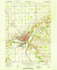
1952 Map of Wabash
USGS Topo · Published 1952About this map
The Wabash River carves a deep valley through this mid-century landscape, anchoring the city of Wabash as it expands along its northern banks. The urban center is clearly defined by a grid of streets including Wabash Street and Cass St, centering on the Court House and Post Office. This era shows a community in transition, where established residential blocks meet industrial and transport corridors like the New York Central railroad.
Find a feature on this map
36 named features on this map. Tap any name to fly to it.
Don’t see what you’re looking for? This feature index may not catch every label — zoom into the map to look around manually.
Map Details
Editions of this 1952 Wabash Map
2 editions found
Other maps of this area

1950 · Lagro
USGS Topo · 1:24,000

1951 · Lagro
USGS Topo · 1:24,000

1951 · Richvalley
USGS Topo · 1:24,000

1952 · Wabash
USGS Topo · 1:24,000

1953 · La Fontaine
USGS Topo · 1:24,000

1953 · Somerset
USGS Topo · 1:24,000

1953 · Peoria
USGS Topo · 1:24,000

1953 · Muncie
USGS Topo · 1:250,000

1956 · Muncie
USGS Topo · 1:250,000

1961 · Roann
USGS Topo · 1:24,000