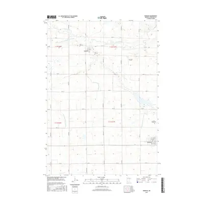
2016 Map of Wabasso
USGS Topo · Published 2016About this map
Wabasso and Seaforth anchor this southwestern Minnesota agricultural landscape in Redwood County, where the meandering course of the Redwood River flows through the northern reaches. The area is defined by a rigorous grid of section lines and rural routes, including Co Rd 7 and Frontier Ave. Local genealogy is well-supported by several significant sites, notably Saint Marys Cem and Saint Pauls Cem, along with the John and Apollenea Daub Family Plot located east of the central valley. The map reveals an extensive drainage network through features like County Ditch Number Ninety and County Ditch Number Twentyone, reflecting the systematic management of the prairie for farming. Small-scale aviation is represented by the Fuhr Flying Service, while the village of Wabasso shows a concentrated street grid including Main St and Cedar St near the southern boundary.
Find a feature on this map
41 named features on this map. Tap any name to fly to it.
Don’t see what you’re looking for? This feature index may not catch every label — zoom into the map to look around manually.
Map Details
Editions of this 2016 Wabasso Map
This is the sole edition of this map. No revisions or reprints were ever made.
Other maps of this area

1952 · Redwood Falls
USGS Topo · 1:62,500

1953 · New Ulm
USGS Topo · 1:250,000

1957 · New Ulm
USGS Topo · 1:250,000

1958 · New Ulm
USGS Topo · 1:250,000

1965 · Echo
USGS Topo · 1:24,000

1965 · Belview
USGS Topo · 1:24,000

1967 · New Ulm
USGS Topo · 1:250,000

1967 · Wanda
USGS Topo · 1:24,000

1967 · Wabasso SE
USGS Topo · 1:24,000

1967 · Wabasso
USGS Topo · 1:24,000