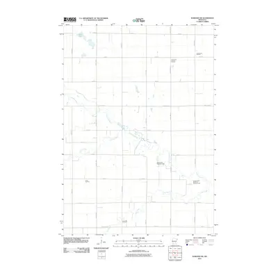
2010 Map of Wabasso SW
USGS Topo · Published 2010About this map
The Cottonwood River meanders across this rural landscape, joined by the waters of Lone Tree Creek and Plum Creek as they traverse the agricultural heart of Redwood County. This area is characterized by a precise grid of rural roads, including County Hwy-10 and County Hwy-5, which connect isolated farmsteads and local landmarks. To the north, Gales Lake sits near the junction of Crown Ave and 220th St. Genealogists will find several significant burial sites documented, such as the Johnsonville Township Cemetery and the North Hero Cemetery. The map also details local water management infrastructure, specifically the Duane Knott Retention Reservoir Dam and the Arlen Knott Detention Dam, reflecting the modern engineering efforts to manage the prairie waterways that define the region's topography.
Find a feature on this map
27 named features on this map. Tap any name to fly to it.
Don’t see what you’re looking for? This feature index may not catch every label — zoom into the map to look around manually.
Map Details
Editions of this 2010 Wabasso SW Map
This is the sole edition of this map. No revisions or reprints were ever made.
Other maps of this area

1953 · New Ulm
USGS Topo · 1:250,000

1957 · New Ulm
USGS Topo · 1:250,000

1958 · New Ulm
USGS Topo · 1:250,000

1962 · Milroy SE
USGS Topo · 1:24,000

1962 · Milroy
USGS Topo · 1:24,000

1967 · New Ulm
USGS Topo · 1:250,000

1967 · Wabasso SE
USGS Topo · 1:24,000

1967 · Wabasso
USGS Topo · 1:24,000

1967 · Walnut Grove
USGS Topo · 1:24,000

1967 · Tracy East
USGS Topo · 1:24,000