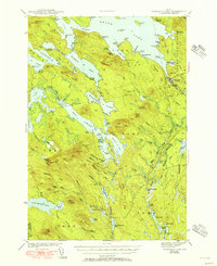
1943 Map of Wabassus Lake
USGS Topo · Published 1950About this map
Wabassus Lake and the complex waterways of eastern Maine are captured here in a 1941 survey, showing the interconnected drainage of the St. Croix River watershed before modern development. The landscape is defined by the labyrinthine shorelines of Sysladobsis Lake, Pocumcus Lake, and Third Machias Lake, separated by historic carries like Dennison Portage. This area in Washington County reflects a late-period frontier economy centered on timber and sporting, evidenced by isolated outposts such as Holland Camp and Knox Lake Camp.
Find a feature on this map
124 named features on this map. Tap any name to fly to it.
Don’t see what you’re looking for? This feature index may not catch every label — zoom into the map to look around manually.
Map Details
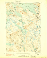
Editions of this 1943 Wabassus Lake Map
3 editions found

Other maps of this area

1929 · Lead Mountain
USGS Topo · 1:48,000

1931 · Springfield
USGS Topo · 1:48,000

1932 · Nicatous Lake
USGS Topo · 1:48,000

1932 · Lead Mountain
USGS Topo · 1:62,500

1934 · Nicatous Lake
USGS Topo · 1:62,500

1934 · Springfield
USGS Topo · 1:62,500

1940 · Waite
USGS Topo · 1:62,500

1941 · Scraggly Lake
USGS Topo · 1:62,500

1941 · Wesley
USGS Topo · 1:62,500

1941 · Tug Mountain
USGS Topo · 1:62,500