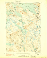
1943 Map of Wabassus Lake
USGS Topo · Published 1950About this map
Grand Lake and a massive network of interconnected water bodies dominate this 1941 survey of Washington County, Maine. The map illustrates a landscape where early 20th-century life centered on the water, with Grand Lake Stream serving as the primary hub of human activity near the eastern edge. Small camps and named landings like The Birches reflect a region defined by recreational fishing and wilderness passage. The topographic detail shows the complex shoreline of Sysladobsis Lake and Pocumcus Lake, where narrow thoroughfares and coves provided the only transit routes through the timbered hills. This survey, completed just before mid-century, records the primitive road network and the isolation of Third Machias Lake and Wabassus Lake before the expansion of modern infrastructure into this part of the Maine interior.
Find a feature on this map
7 named features on this map. Tap any name to fly to it.
Don’t see what you’re looking for? This feature index may not catch every label — zoom into the map to look around manually.
Map Details
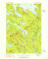
Editions of this 1943 Wabassus Lake Map
3 editions found

Other maps of this area

1929 · Lead Mountain
USGS Topo · 1:48,000

1931 · Springfield
USGS Topo · 1:48,000

1932 · Nicatous Lake
USGS Topo · 1:48,000

1932 · Lead Mountain
USGS Topo · 1:62,500

1934 · Nicatous Lake
USGS Topo · 1:62,500

1934 · Springfield
USGS Topo · 1:62,500

1940 · Waite
USGS Topo · 1:62,500

1941 · Scraggly Lake
USGS Topo · 1:62,500

1941 · Wesley
USGS Topo · 1:62,500

1941 · Tug Mountain
USGS Topo · 1:62,500