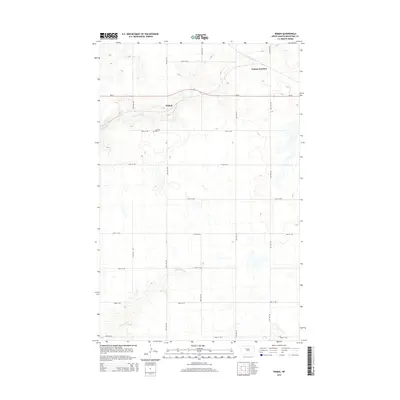
2014 Map of Wabek
USGS Topo · Published 2014About this map
The small settlement of Wabek anchors this northern plains landscape in Mountrail County, characterized by a structured grid of rural roads and the meandering drainage of the E Fork Shell Cr. This 2014 survey captures a quiet agricultural region where the Lutheran Cem stands as a focal point for local family history and genealogy. To the northeast, the intersection at Prairie Junction marks a key node along the ND-23 corridor, which serves as the primary east-west artery through the township. The terrain is defined by its water systems, with the southern portion of the map drained by the winding course of Deepwater Cr. This document provides a clear view of the modern rural infrastructure, from the systematic naming of section-line roads like 64th Ave NW to the preservation of traditional local landmarks.
Find a feature on this map
20 named features on this map. Tap any name to fly to it.
Don’t see what you’re looking for? This feature index may not catch every label — zoom into the map to look around manually.
Map Details
Editions of this 2014 Wabek Map
This is the sole edition of this map. No revisions or reprints were ever made.
Other maps of this area

1953 · Williston
USGS Topo · 1:250,000

1953 · Watford City
USGS Topo · 1:250,000

1954 · Minot
USGS Topo · 1:250,000

1954 · McClusky
USGS Topo · 1:250,000

1956 · Makoti SW
USGS Topo · 1:24,000

1956 · Roseglen
USGS Topo · 1:24,000

1957 · Williston
USGS Topo · 1:250,000

1957 · Watford City
USGS Topo · 1:250,000

1958 · McClusky
USGS Topo · 1:250,000

1958 · Minot
USGS Topo · 1:250,000