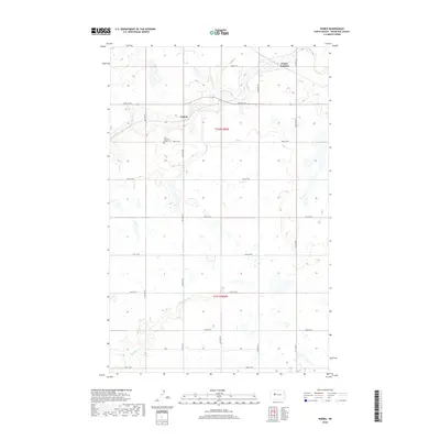
2018 Map of Wabek
USGS Topo · Published 2018About this map
Wabek and the nearby First Lutheran Wabek Cem anchor this section of Mountrail County, representing a persistent agricultural landscape of the North Dakota plains. The map illustrates a highly organized township structure, defined by a grid of numbered roads including 39th St NW and 64th Ave NW. This geometry is broken only by the natural meandering paths of local waterways like Deepwater Cr and the E Fork Shell Cr. At Prairie Junction, the intersection of major county routes serves as a local navigational hub. The terrain is dotted with small wetlands and depressions typical of the regional prairie pothole landscape, showing how agricultural development has navigated these natural features while maintaining the strict section lines of the Public Land Survey System.
Find a feature on this map
24 named features on this map. Tap any name to fly to it.
Don’t see what you’re looking for? This feature index may not catch every label — zoom into the map to look around manually.
Map Details
Editions of this 2018 Wabek Map
This is the sole edition of this map. No revisions or reprints were ever made.
Other maps of this area

1953 · Williston
USGS Topo · 1:250,000

1953 · Watford City
USGS Topo · 1:250,000

1954 · Minot
USGS Topo · 1:250,000

1954 · McClusky
USGS Topo · 1:250,000

1956 · Makoti SW
USGS Topo · 1:24,000

1956 · Roseglen
USGS Topo · 1:24,000

1957 · Williston
USGS Topo · 1:250,000

1957 · Watford City
USGS Topo · 1:250,000

1958 · McClusky
USGS Topo · 1:250,000

1958 · Minot
USGS Topo · 1:250,000