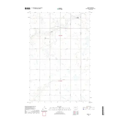
2020 Map of Wabek
USGS Topo · Published 2020About this map
The Missouri Plateau of North Dakota is defined here by a network of drainage systems and the rectilinear grid of section roads. The small settlement of Wabek and the nearby First Lutheran Wabek Cem serve as the primary landmarks in this rural landscape, situated within the bounds of t152n r88w. The terrain is shaped by the headwaters of several drainages, including the eastward-flowing E Fork Shell Cr and the southerly Deepwater Cr, which is joined by E Fork Deepwater Cr in the southern reaches of the quadrangle. In the northeastern corner, Prairie Junction marks a intersection of local roads, illustrating the systematic organization of the prairie into a functional agricultural and transit grid during the early 21st century.
Find a feature on this map
23 named features on this map. Tap any name to fly to it.
Don’t see what you’re looking for? This feature index may not catch every label — zoom into the map to look around manually.
Map Details
Editions of this 2020 Wabek Map
This is the sole edition of this map. No revisions or reprints were ever made.
Other maps of this area

1953 · Williston
USGS Topo · 1:250,000

1953 · Watford City
USGS Topo · 1:250,000

1954 · Minot
USGS Topo · 1:250,000

1954 · McClusky
USGS Topo · 1:250,000

1956 · Makoti SW
USGS Topo · 1:24,000

1956 · Roseglen
USGS Topo · 1:24,000

1957 · Williston
USGS Topo · 1:250,000

1957 · Watford City
USGS Topo · 1:250,000

1958 · McClusky
USGS Topo · 1:250,000

1958 · Minot
USGS Topo · 1:250,000