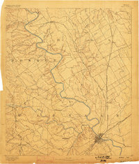
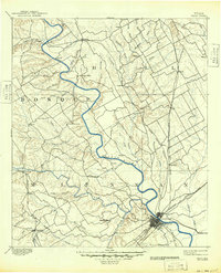
1892 Map of Waco
USGS Topo · Published 1898About this map
The Brazos River carves a winding path through the center of this Central Texas landscape, serving as a primary geographical divider during the late nineteenth century. In Waco, the street grid is already established at the confluence of the river and the Texas & Arkansas Railway, marking the city's emergence as a regional hub for trade and transport. The surrounding prairie is dotted with small rural settlements like China Springs, Gholson, and Speegleville, many of which remain today as key landmarks for local genealogists.
Find a feature on this map
60 named features on this map. Tap any name to fly to it.
Don’t see what you’re looking for? This feature index may not catch every label — zoom into the map to look around manually.
Map Details
Editions of this 1892 Waco Map
6 editions found
Other maps of this area

1888 · Meridian
USGS Topo · 1:125,000

1889 · Granbury
USGS Topo · 1:125,000

1891 · Cleburne
USGS Topo · 1:125,000

1892 · Temple
USGS Topo · 1:125,000

1892 · Waco
USGS Topo · 1:125,000

1894 · Meridian
USGS Topo · 1:125,000

1894 · Gatesville
USGS Topo · 1:125,000

1894 · Cleburne
USGS Topo · 1:125,000

1920 · Waco
USGS Topo · 1:125,000

1920 · Mart
USGS Topo · 1:62,500