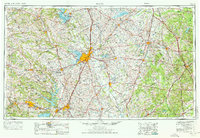
1954 Map of Waco
USGS Topo · Published 1976About this map
Waco and its surrounding central Texas counties appear here during a period of significant mid-century infrastructure growth and military expansion. The landscape is defined by the convergence of the Brazos River and the North Bosque River, with the recently developed Waco Lake and Lake Whitney altering the river valleys. To the west, the massive Fort Hood Military Reservation dominates the terrain near Killeen, while the Naval Industrial Reserve Ordnance Plant reflects the era's industrial footprint.
Find a feature on this map
212 named features on this map. Tap any name to fly to it.
Don’t see what you’re looking for? This feature index may not catch every label — zoom into the map to look around manually.
Map Details
Editions of this 1954 Waco Map
2 editions found

Other maps of this area

1885 · Taylor
USGS Topo · 1:125,000

1887 · Taylor
USGS Topo · 1:125,000

1887 · Lampasas
USGS Topo · 1:125,000

1887 · Burnet
USGS Topo · 1:125,000

1888 · Hamilton
USGS Topo · 1:125,000

1888 · Meridian
USGS Topo · 1:125,000

1889 · Granbury
USGS Topo · 1:125,000

1890 · Stephenville
USGS Topo · 1:125,000

1891 · Cleburne
USGS Topo · 1:125,000

1892 · Temple
USGS Topo · 1:125,000