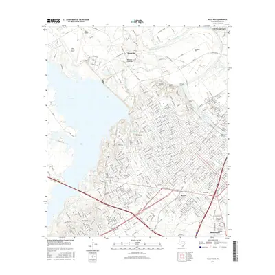
2016 Map of Waco West
USGS Topo · Published 2016About this map
The Brazos River carves a winding path through the heart of Waco, serving as the geographic anchor for the city's development and infrastructure. Key crossings like the Waco Suspension Bridge and the Washington Avenue Bridge connect the urban core with the residential expansions to the east. To the west, the expansive waters of Waco Lake define the shoreline, bordered by neighborhoods in Woodway and landmark sites like Greenwood Cem.
Find a feature on this map
443 named features on this map. Tap any name to fly to it.
Don’t see what you’re looking for? This feature index may not catch every label — zoom into the map to look around manually.
Map Details
Editions of this 2016 Waco West Map
This is the sole edition of this map. No revisions or reprints were ever made.
Other maps of this area

1892 · Temple
USGS Topo · 1:125,000

1892 · Waco
USGS Topo · 1:125,000

1920 · Waco
USGS Topo · 1:125,000

1924 · Waco 4-c
USGS Topo · 1:48,000

1924 · Waco 3-d
USGS Topo · 1:48,000

1931 · Valley Mills
USGS Topo · 1:62,500

1931 · Elm Mott
USGS Topo · 1:62,500

1931 · Mc Gregor
USGS Topo · 1:62,500

1954 · Waco
USGS Topo · 1:250,000

1955 · Waco
USGS Topo · 1:250,000