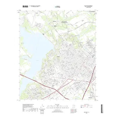
2019 Map of Waco West
USGS Topo · Published 2019About this map
Waco Mammoth National Monument and the steep riverine cliffs of Lovers Leap and Emmons Cliff define the northern landscape of this region where the Brazos River meets the Bosque River. The urban development of Waco is documented in high detail, showing the street grids and bridge crossings including the Waco Suspension Bridge and Washington Avenue Bridge. To the west, the massive footprint of Waco Lake contrasts with the residential patterns of Woodway and the industrial and suburban clusters around Beverly Hills and Lacy-Lakeview. Local history and genealogy researchers can locate several smaller named communities such as Bosqueville, Bannas Junction, and Jewell, alongside landmarks like Greenwood Cem and Waco Regional Airport.
Find a feature on this map
247 named features on this map. Tap any name to fly to it.
Don’t see what you’re looking for? This feature index may not catch every label — zoom into the map to look around manually.
Map Details
Editions of this 2019 Waco West Map
This is the sole edition of this map. No revisions or reprints were ever made.
Other maps of this area

1892 · Temple
USGS Topo · 1:125,000

1892 · Waco
USGS Topo · 1:125,000

1920 · Waco
USGS Topo · 1:125,000

1924 · Waco 4-c
USGS Topo · 1:48,000

1924 · Waco 3-d
USGS Topo · 1:48,000

1931 · Valley Mills
USGS Topo · 1:62,500

1931 · Elm Mott
USGS Topo · 1:62,500

1931 · Mc Gregor
USGS Topo · 1:62,500

1954 · Waco
USGS Topo · 1:250,000

1955 · Waco
USGS Topo · 1:250,000