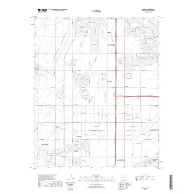
2018 Map of Waddell
USGS Topo · Published 2018About this map
The White Tank Mountains dominate the western edge of this landscape, where the desert terrain gives way to the rapid suburban expansion of the West Valley. This era of development is visible in the dense grid of residential streets like W Waddell Rd and W Cactus Rd that surround the established communities of Waddell and Surprise. The eastern half of the map is defined by major infrastructure and military presence, notably the western portion of Luke Air Force Base and the small settlements of Wayne and Citrus Park. Numerous desert washes, including Waterfall Wash and Cholla Wash, drain eastward from the mountains toward the Beardsley Canal Wash. These drainage patterns, including the prominent Detention Basin, illustrate the management of water in this arid environment as municipalities like Buckeye and Goodyear extend their reaches into formerly open desert.
Find a feature on this map
161 named features on this map. Tap any name to fly to it.
Don’t see what you’re looking for? This feature index may not catch every label — zoom into the map to look around manually.
Map Details
Editions of this 2018 Waddell Map
This is the sole edition of this map. No revisions or reprints were ever made.
Other maps of this area

1946 · Avondale
USGS Topo · 1:62,500

1948 · Cashion
USGS Topo · 1:62,500

1954 · Phoenix
USGS Topo · 1:250,000

1957 · Phoenix
USGS Topo · 1:250,000

1957 · White Tank Mts. SE
USGS Topo · 1:24,000

1957 · Valencia
USGS Topo · 1:24,000

1957 · Perryville
USGS Topo · 1:24,000

1957 · White Tank Mts. NE
USGS Topo · 1:24,000

1957 · Calderwood Butte
USGS Topo · 1:24,000

1957 · McMicken Dam
USGS Topo · 1:24,000