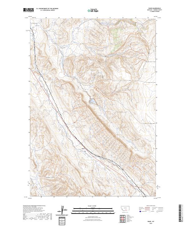
2024 Map of Wade
USGS Topo · Published 2024About this map
Wade sits at the heart of this Carbon County landscape, where the drainage systems of the Pryor Mountains define the settlement patterns. The terrain is characterized by deep incisions like Castle Coulee, while the hydrology is dominated by the branching reaches of Bridger Creek, including its North Fork and South Fork. These watercourses, along with Jack Creek and Gyp Creek, create a complex network of ridges and valleys that have historically dictated the placement of roads and small holdings.
Find a feature on this map
17 named features on this map. Tap any name to fly to it.
Don’t see what you’re looking for? This feature index may not catch every label — zoom into the map to look around manually.
Map Details
Editions of this 2024 Wade Map
This is the sole edition of this map. No revisions or reprints were ever made.
Other maps of this area

1954 · Billings
USGS Topo · 1:250,000

1956 · Bridger
USGS Topo · 1:24,000

1957 · Billings
USGS Topo · 1:250,000

1958 · Billings
USGS Topo · 1:250,000

1967 · Section House Draw
USGS Topo · 1:24,000

1967 · Bluewater
USGS Topo · 1:24,000

1969 · Warren
USGS Topo · 1:24,000

1969 · Bowler
USGS Topo · 1:24,000
1969 · Hatcher Pass
USGS Topo · 1:24,000
1969 · Hunters Creek
USGS Topo · 1:24,000