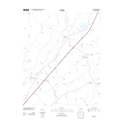
2013 Map of Wade
USGS Topo · Published 2013About this map
The Cape Fear River and Black River converge toward the northeast in this rural stretch of Cumberland County, where a series of small 21st-century settlements sit between the riverbanks and the interstate corridor. The town of Wade serves as a primary hub in the south, while the communities of Godwin and Falcon anchor the central portion of the quadrangle. Local road networks like Colliers Chapel Church Rd suggest long-standing rural community centers and religious sites that have persisted as the area evolved. Toward the eastern boundary, the S River and Mingo Swamp create a complex wetland environment, punctuated by crossings such as Starling Bridge and Grahams Bridge. Rhodes Pond stands out as a significant local water feature, reflecting the landscape's character where agricultural land meets the slow-moving drainage systems of the North Carolina coastal plain.
Find a feature on this map
94 named features on this map. Tap any name to fly to it.
Don’t see what you’re looking for? This feature index may not catch every label — zoom into the map to look around manually.
Map Details
Editions of this 2013 Wade Map
This is the sole edition of this map. No revisions or reprints were ever made.
Other maps of this area

1948 · Fayetteville
USGS Topo · 1:62,500

1948 · Slocomb
USGS Topo · 1:24,000

1949 · Vander
USGS Topo · 1:24,000

1950 · Slocomb
USGS Topo · 1:24,000

1953 · Raleigh
USGS Topo · 1:250,000

1954 · Raleigh
USGS Topo · 1:250,000

1956 · Bunnlevel
USGS Topo · 1:24,000

1957 · Vander
USGS Topo · 1:24,000

1957 · Fayetteville
USGS Topo · 1:62,500

1973 · Dunn
USGS Topo · 1:24,000