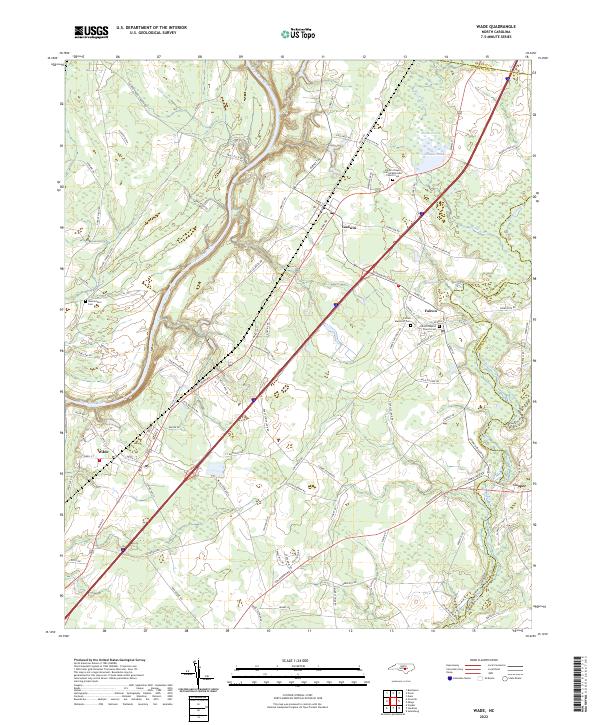
2022 Map of Wade
USGS Topo · Published 2022About this map
The Cape Fear River winds through this landscape near the border of Harnett Co, Cumberland Co, and Sampson Co, defining a region marked by extensive wetlands and drainage systems like Mingo Swamp and the Black River. The settlement pattern follows the high ground between these watercourses, anchored by the towns of Wade, Godwin, and Falcon.
Find a feature on this map
91 named features on this map. Tap any name to fly to it.
Don’t see what you’re looking for? This feature index may not catch every label — zoom into the map to look around manually.
Map Details
Editions of this 2022 Wade Map
This is the sole edition of this map. No revisions or reprints were ever made.
Other maps of this area

1948 · Fayetteville
USGS Topo · 1:62,500

1948 · Slocomb
USGS Topo · 1:24,000

1949 · Vander
USGS Topo · 1:24,000

1950 · Slocomb
USGS Topo · 1:24,000

1953 · Raleigh
USGS Topo · 1:250,000

1954 · Raleigh
USGS Topo · 1:250,000

1956 · Bunnlevel
USGS Topo · 1:24,000

1957 · Vander
USGS Topo · 1:24,000

1957 · Fayetteville
USGS Topo · 1:62,500

1973 · Dunn
USGS Topo · 1:24,000