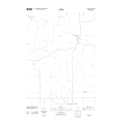
2013 Map of Wadena
USGS Topo · Published 2013About this map
The Volga River carves a winding path through this portion of Fayette County, anchoring the small settlements of Wadena and Lima. This 2013 survey illustrates a landscape defined by its riparian corridors and agricultural grid, with the community of Arlington situated at the southern edge. Local history and genealogy enthusiasts can trace the placement of smaller locales like Taylorsville and geographical landmarks such as Corn Hill and Bear Hill. The intricate drainage network of Brush Cr, Mink Cr, and Grannis Cr shapes the valley floor, while features like Blue Spring highlight the area's natural hydrology. The map provides a detailed view of local infrastructure, from the residential blocks of Wadena near W Herriman Ave to the Volga River Access points used by residents.
Find a feature on this map
64 named features on this map. Tap any name to fly to it.
Don’t see what you’re looking for? This feature index may not catch every label — zoom into the map to look around manually.
Map Details
Editions of this 2013 Wadena Map
This is the sole edition of this map. No revisions or reprints were ever made.
Other maps of this area

1901 · Oelwein
USGS Topo · 1:125,000

1959 · Dubuque
USGS Topo · 1:250,000

1961 · Dubuque
USGS Topo · 1:250,000

1962 · Dubuque
USGS Topo · 1:250,000

1965 · Elgin
USGS Topo · 1:24,000

1965 · Wadena
USGS Topo · 1:24,000
1965 · Gunder
USGS Topo · 1:24,000

1965 · Strawberry Point
USGS Topo · 1:24,000

1965 · Arlington
USGS Topo · 1:24,000
1965 · Volga
USGS Topo · 1:24,000