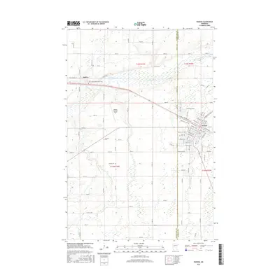
2016 Map of Wadena
USGS Topo · Published 2016About this map
The Leaf River and its meandering tributaries dominate the landscape of this central Minnesota region, where the prairie begins to meet the north woods. The city of Wadena serves as the primary hub, showing a detailed street grid including Ash Ave NW and Bryant Ave SE, alongside the Wadena Municipal Airport. To the northwest, the smaller settlement of Bluffton sits near the banks of Bluff Cr, marking a quiet rural center defined by its connection to the water.
Find a feature on this map
96 named features on this map. Tap any name to fly to it.
Don’t see what you’re looking for? This feature index may not catch every label — zoom into the map to look around manually.
Map Details
Editions of this 2016 Wadena Map
This is the sole edition of this map. No revisions or reprints were ever made.
Other maps of this area

1953 · Brainerd
USGS Topo · 1:250,000

1957 · Brainerd
USGS Topo · 1:250,000

1958 · Brainerd
USGS Topo · 1:250,000

1965 · Brainerd
USGS Topo · 1:250,000

1969 · Sebeka SW
USGS Topo · 1:24,000

1969 · Henning SE
USGS Topo · 1:24,000

1969 · Bertha
USGS Topo · 1:24,000

1969 · Wrightstown
USGS Topo · 1:24,000

1969 · Wadena
USGS Topo · 1:24,000
1969 · Deer Creek
USGS Topo · 1:24,000