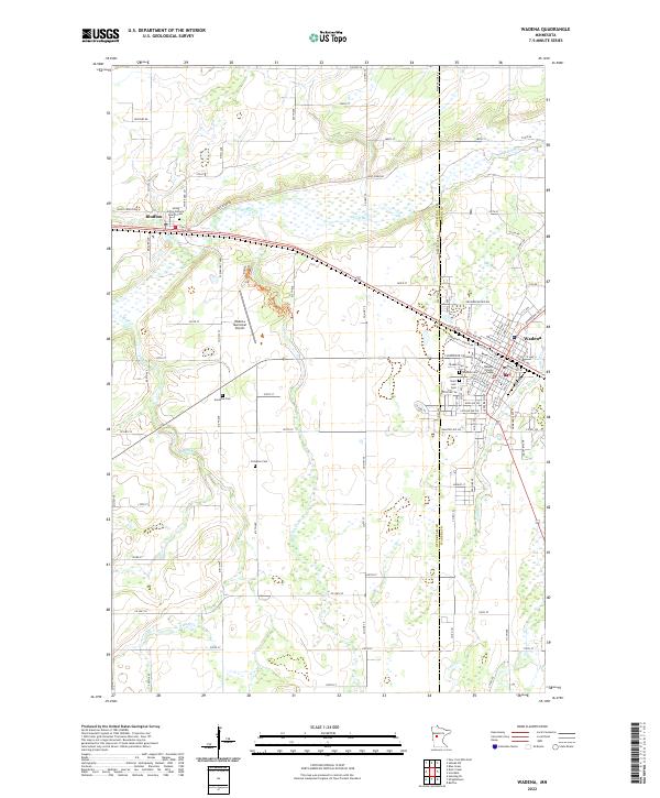
2022 Map of Wadena
USGS Topo · Published 2022About this map
The Leaf River meanders across the northern portion of this landscape, marking a transition between the established community center of Wadena and the village of Bluffton. This survey captures the region's civic and spiritual infrastructure, anchored by the Wadena County Courthouse and numerous burial grounds that reflect the area's ancestral heritage. Genealogists will find several notable sites, including the Saint John's Catholic Church Cem and the Gustafva Cem north of the airport. The drainage patterns of Bluff Cr, S Bluff Cr, and Union Cr define the low-lying areas between the township grids of T135N R36W and T134N R35W. Infrastructure such as the Wadena Municipal Airport and the county boundary between Otter Tail and Wadena Counties show how the land is organized for modern aviation and administration.
Find a feature on this map
105 named features on this map. Tap any name to fly to it.
Don’t see what you’re looking for? This feature index may not catch every label — zoom into the map to look around manually.
Map Details
Editions of this 2022 Wadena Map
This is the sole edition of this map. No revisions or reprints were ever made.
Other maps of this area

1953 · Brainerd
USGS Topo · 1:250,000

1957 · Brainerd
USGS Topo · 1:250,000

1958 · Brainerd
USGS Topo · 1:250,000

1965 · Brainerd
USGS Topo · 1:250,000

1969 · Sebeka SW
USGS Topo · 1:24,000

1969 · Henning SE
USGS Topo · 1:24,000

1969 · Bertha
USGS Topo · 1:24,000

1969 · Wrightstown
USGS Topo · 1:24,000

1969 · Wadena
USGS Topo · 1:24,000
1969 · Deer Creek
USGS Topo · 1:24,000