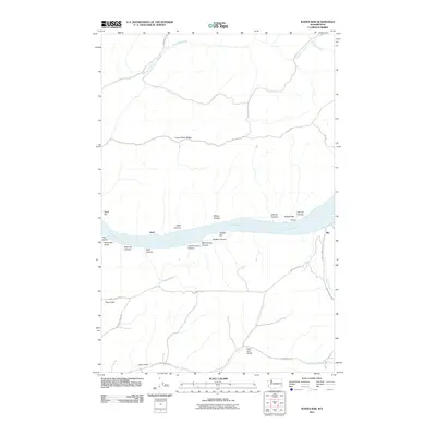
2011 Map of Wades Bar
USGS Topo · Published 2011About this map
Lake Bryan dominates the center of this landscape, a reservoir of the Snake River that defines the local geography. Small settlements and former landings like Swift, Schultz, and Illia sit along the northern and southern banks, serving as points of reference in an area characterized by deep drainage systems and high ridges. The map reveals a complex network of canyons and bars, including Wades Bar, Swift Bar, and Schultz Bar, which highlight the historical riverbed before the impoundment.
Find a feature on this map
36 named features on this map. Tap any name to fly to it.
Don’t see what you’re looking for? This feature index may not catch every label — zoom into the map to look around manually.
Map Details
Editions of this 2011 Wades Bar Map
This is the sole edition of this map. No revisions or reprints were ever made.
Other maps of this area

1910 · Pullman
USGS Topo · 1:125,000

1950 · Penawawa
USGS Topo · 1:62,500

1950 · Endicott
USGS Topo · 1:62,500

1955 · Pullman
USGS Topo · 1:250,000

1958 · Pullman
USGS Topo · 1:250,000

1964 · Wilcox
USGS Topo · 1:24,000

1964 · Kirby
USGS Topo · 1:24,000
1964 · Almota
USGS Topo · 1:24,000

1981 · Dusty
USGS Topo · 1:24,000
1981 · Falling Springs
USGS Topo · 1:24,000