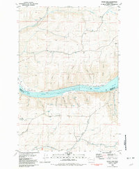
1981 Map of Wades Bar
USGS Topo · Published 1981About this map
The Lake Bryan Snake River dominates this stretch of the Pacific Northwest, marking the boundary between Whitman and Garfield Counties. The landscape is defined by the steep canyon walls and tributary systems of the Snake River canyon, featuring prominent bars along the riverbank such as Wades Bar, Swift Bar, and Prairie Bar. These alluvial features, coupled with the rugged topography of Long Ridge and Long Hollow Ridge, illustrate the complex erosion patterns that shaped this river valley.
Find a feature on this map
35 named features on this map. Tap any name to fly to it.
Don’t see what you’re looking for? This feature index may not catch every label — zoom into the map to look around manually.
Map Details
Editions of this 1981 Wades Bar Map
This is the sole edition of this map. No revisions or reprints were ever made.
Other maps of this area

1910 · Pullman
USGS Topo · 1:125,000

1950 · Penawawa
USGS Topo · 1:62,500

1950 · Endicott
USGS Topo · 1:62,500

1955 · Pullman
USGS Topo · 1:250,000

1958 · Pullman
USGS Topo · 1:250,000

1964 · Wilcox
USGS Topo · 1:24,000

1964 · Kirby
USGS Topo · 1:24,000
1964 · Almota
USGS Topo · 1:24,000

1981 · Dusty
USGS Topo · 1:24,000
1981 · Falling Springs
USGS Topo · 1:24,000