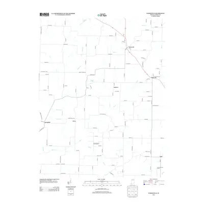
2013 Map of Wadesville
USGS Topo · Published 2013About this map
Wadesville and Blairsville anchor the northeastern portion of this Posey County landscape, where the rural topography is defined by the winding paths of Big Cr and its many tributaries like Lick Cr and McAdoo Cr. The area reflects a complex mix of agricultural land and industrial utility, most notably seen in the Oliver Underground Gas Storage Area situated near the center of the quadrangle. Small clusters of historical interest such as Hepburn, Springfield, and Oliver are connected by a dense network of county roads including Springfield Rd and Oliver Springfield Rd. The presence of the Schroeder Private Airport near the southeastern corner at Lippe suggests the specialized land uses common in this part of Indiana during the early twenty-first century.
Find a feature on this map
109 named features on this map. Tap any name to fly to it.
Don’t see what you’re looking for? This feature index may not catch every label — zoom into the map to look around manually.
Map Details
Editions of this 2013 Wadesville Map
This is the sole edition of this map. No revisions or reprints were ever made.
Other maps of this area

1901 · Haubstadt
USGS Topo · 1:62,500

1903 · Haubstadt
USGS Topo · 1:62,500

1903 · New Harmony
USGS Topo · 1:62,500

1903 · Patoka
USGS Topo · 1:125,000

1914 · Henderson
USGS Topo · 1:48,000

1916 · Henderson
USGS Topo · 1:62,500

1917 · Uniontown
USGS Topo · 1:62,500

1938 · New Harmony
USGS Topo · 1:62,500
1952 · Mount Vernon
USGS Topo · 1:24,000

1954 · Evansville
USGS Topo · 1:250,000