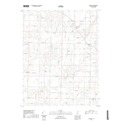
2019 Map of Wadesville
USGS Topo · Published 2019About this map
Wadesville and Blairsville anchor this southern Indiana landscape, where established unincorporated communities are connected by a network of rural routes through Posey County. The area is defined by its water drainage patterns, with McAdoo Cr, Lick Cr, and Big Creek carving through the agricultural terrain. Small-scale settlements like Hepburn, Oliver, and Springfield are scattered across the landscape, reflecting a long history of rural residence. For genealogists, the map identifies local burial sites such as Laurel Hill Cem and Downen Cem, which provide specific points of reference for family research. High ground at Laurel Hill overlooks a mix of woodlots and open fields, while more modern developments like the Schroeder Private Airport sit alongside older creek-fed landmarks like Knowles Lake.
Find a feature on this map
97 named features on this map. Tap any name to fly to it.
Don’t see what you’re looking for? This feature index may not catch every label — zoom into the map to look around manually.
Map Details
Editions of this 2019 Wadesville Map
This is the sole edition of this map. No revisions or reprints were ever made.
Other maps of this area

1901 · Haubstadt
USGS Topo · 1:62,500

1903 · Haubstadt
USGS Topo · 1:62,500

1903 · New Harmony
USGS Topo · 1:62,500

1903 · Patoka
USGS Topo · 1:125,000

1914 · Henderson
USGS Topo · 1:48,000

1916 · Henderson
USGS Topo · 1:62,500

1917 · Uniontown
USGS Topo · 1:62,500

1938 · New Harmony
USGS Topo · 1:62,500
1952 · Mount Vernon
USGS Topo · 1:24,000

1954 · Evansville
USGS Topo · 1:250,000