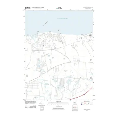
2010 Map of Wading River
USGS Topo · Published 2010About this map
Wading River and the rural landscape of eastern Long Island are documented here, showing a transition from coastal bluffs to interior wetlands and agricultural tracts. The shoreline is defined by landmarks like Herod Point and West Landing, while the interior features a high concentration of fresh water bodies, including Lake Panamoka, Deep Pond, and the Peconic River. This landscape reflects a mix of traditional land use and large-scale public and private facilities, ranging from the Davis Peach Farm and Baiting Hollow Farm Vineyard to the expansive Calverton National Cemetery and the adjacent Calverton Executive Airport. Historical burial sites such as Olivers Hill Cemetery and Wells Cemetery are situated among established settlements like Manorville and Wildwood. The area's legacy as a recreational destination is evident in the cluster of camps along the north shore, including Camp DeWolf and Camp Baiting Hollow.
Find a feature on this map
79 named features on this map. Tap any name to fly to it.
Don’t see what you’re looking for? This feature index may not catch every label — zoom into the map to look around manually.
Map Details
Editions of this 2010 Wading River Map
This is the sole edition of this map. No revisions or reprints were ever made.
Other maps of this area

1903 · Riverhead
USGS Topo · 1:62,500

1904 · Riverhead
USGS Topo · 1:62,500

1904 · Moriches
USGS Topo · 1:62,500

1943 · Riverhead
USGS Topo · 1:62,500

1947 · Bellport
USGS Topo · 1:24,000

1947 · Riverhead
USGS Topo · 1:24,000

1947 · Eastport
USGS Topo · 1:24,000
1947 · Middle Island
USGS Topo · 1:24,000

1947 · Hartford
USGS Topo · 1:250,000

1948 · Hartford
USGS Topo · 1:250,000