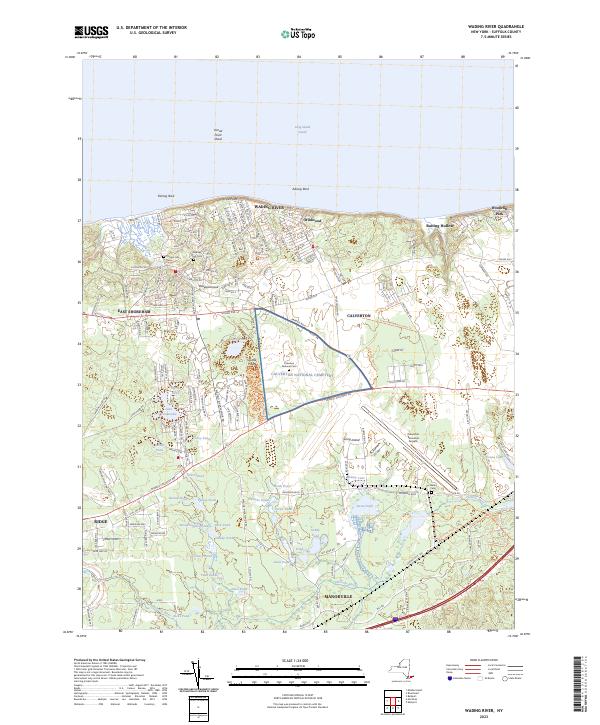
2023 Map of Wading River
USGS Topo · Published 2023About this map
The coastal village of Wading River and the northern reaches of the Peconic River watershed anchor this detailed survey of Suffolk County’s North Shore. The landscape is characterized by a dense network of glacial kettle ponds, including Lake Panamoka, Deep Pond, and Swan Pond, which sit amidst the sandy pine barrens. The transition from the bluffs of Long Island Sound to the interior lowlands is marked by significant landmarks like the expansive Calverton National Cem and the Calverton Executive Airpark. This modern view illustrates the ongoing balance between the preservation of open water bodies and the residential expansion of communities like East Shoreham and Ridge. Genealogists will find the map particularly useful for locating smaller burial grounds such as Wells Cem and the central Wading River Cem, which serves as a historical focal point for the settlement near Herod Point.
Find a feature on this map
158 named features on this map. Tap any name to fly to it.
Don’t see what you’re looking for? This feature index may not catch every label — zoom into the map to look around manually.
Map Details
Editions of this 2023 Wading River Map
This is the sole edition of this map. No revisions or reprints were ever made.
Other maps of this area

1903 · Riverhead
USGS Topo · 1:62,500

1904 · Riverhead
USGS Topo · 1:62,500

1904 · Moriches
USGS Topo · 1:62,500

1943 · Riverhead
USGS Topo · 1:62,500

1947 · Bellport
USGS Topo · 1:24,000

1947 · Riverhead
USGS Topo · 1:24,000

1947 · Eastport
USGS Topo · 1:24,000
1947 · Middle Island
USGS Topo · 1:24,000

1947 · Hartford
USGS Topo · 1:250,000

1948 · Hartford
USGS Topo · 1:250,000