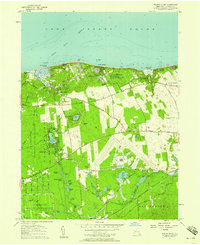
1957 Map of Wading River
USGS Topo · Published 1958About this map
Wading River and the northern shoreline of Long Island Sound characterize this mid-century Long Island landscape. The survey documents a transition from the agricultural roots of Manorville and Baiting Hollow toward significant institutional and industrial development. Large-scale land use is dominated by the Brookhaven National Laboratory US Reservation and the extensive Grumman Airport, while the coast is dotted with seasonal destinations like Wildwood State Park and various youth camps, including Camp Wauwepex and Camp Baiting Hollow.
Find a feature on this map
79 named features on this map. Tap any name to fly to it.
Don’t see what you’re looking for? This feature index may not catch every label — zoom into the map to look around manually.
Map Details
Editions of this 1957 Wading River Map
This is the sole edition of this map. No revisions or reprints were ever made.
Other maps of this area

1903 · Riverhead
USGS Topo · 1:62,500

1904 · Riverhead
USGS Topo · 1:62,500

1904 · Moriches
USGS Topo · 1:62,500

1943 · Riverhead
USGS Topo · 1:62,500

1947 · Bellport
USGS Topo · 1:24,000

1947 · Riverhead
USGS Topo · 1:24,000

1947 · Eastport
USGS Topo · 1:24,000
1947 · Middle Island
USGS Topo · 1:24,000

1947 · Hartford
USGS Topo · 1:250,000

1948 · Hartford
USGS Topo · 1:250,000