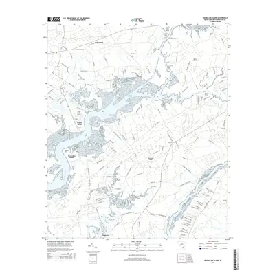
2017 Map of Wadmalaw Island
USGS Topo · Published 2017About this map
Wadmalaw Island serves as the centerpiece for this coastal landscape, defined by an intricate network of tidal creeks and marshes. The transition from the rural settlements of Hollywood and Meggett to the winding banks of the Bohicket Cr reveals a region deeply tied to its maritime environment. This modern survey documents the contemporary boundaries of agricultural lands and residential growth, while preserving the location of small, family-associated landmarks such as Parker Cem and Chaplin Cem.
Find a feature on this map
130 named features on this map. Tap any name to fly to it.
Don’t see what you’re looking for? This feature index may not catch every label — zoom into the map to look around manually.
Map Details
Editions of this 2017 Wadmalaw Island Map
This is the sole edition of this map. No revisions or reprints were ever made.
Other maps of this area

1918 · Kiawah Island
USGS Topo · 1:21,120

1918 · Cottageville
USGS Topo · 1:62,500

1919 · Johns Island
USGS Topo · 1:21,120

1919 · Edisto Island
USGS Topo · 1:62,500

1919 · Wadmelaw Island
USGS Topo · 1:62,500

1919 · Legareville
USGS Topo · 1:21,120

1920 · Ravenels
USGS Topo · 1:62,500

1943 · Cottageville
USGS Topo · 1:62,500

1943 · Legareville
USGS Topo · 1:24,000

1943 · Edisto Island
USGS Topo · 1:62,500