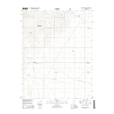
2014 Map of Wadsworth Ranch
USGS Topo · Published 2014About this map
Wadsworth Ranch sits at the northern edge of this high-desert basin, where the Humboldt National Forest meets the wide, dry expanse of Garden Valley. The landscape is defined by its water sources, with numerous springs such as Black Spring, Battaman Spring, and Pine Creek Spring scattered across the alluvial fans. These vital points of hydration supported the ranching operations and travelers moving through the territory.
Find a feature on this map
25 named features on this map. Tap any name to fly to it.
Don’t see what you’re looking for? This feature index may not catch every label — zoom into the map to look around manually.
Map Details
Editions of this 2014 Wadsworth Ranch Map
This is the sole edition of this map. No revisions or reprints were ever made.
Other maps of this area

1942 · Penoyer Valley
USGS Topo · 1:125,000

1954 · Caliente
USGS Topo · 1:250,000

1956 · Lund
USGS Topo · 1:250,000

1959 · Caliente
USGS Topo · 1:250,000

1960 · Lund
USGS Topo · 1:250,000

1985 · Adaven
USGS Topo · 1:24,000

1985 · Worthington Peak
USGS Topo · 1:24,000

1985 · McCutchen Spring
USGS Topo · 1:24,000
1985 · Badger Gulch
USGS Topo · 1:24,000

1985 · Murphy Gap NW
USGS Topo · 1:24,000