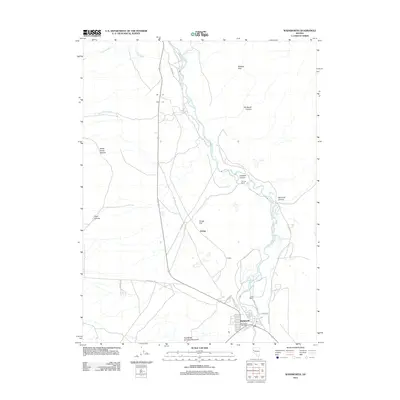
2011 Map of Wadsworth
USGS Topo · Published 2011About this map
The Truckee River carves a winding path through this corner of Lyon County, defining the corridor where human settlement and transportation intersect with the desert landscape. The town of Wadsworth serves as the primary hub, anchored by the Wadsworth Post Office and a network of residential streets like Tumbleweed St and Sagebrush St. This 2011 survey reveals a landscape shaped by both natural features and long-established ranching interests, with the James Ranch and Thomas Ranch appearing along the river's fertile edge.
Find a feature on this map
30 named features on this map. Tap any name to fly to it.
Don’t see what you’re looking for? This feature index may not catch every label — zoom into the map to look around manually.
Map Details
Editions of this 2011 Wadsworth Map
This is the sole edition of this map. No revisions or reprints were ever made.
Other maps of this area

1890 · Wadsworth
USGS Topo · 1:125,000

1892 · Wadsworth
USGS Topo · 1:125,000

1894 · Wadsworth
USGS Topo · 1:125,000

1957 · Fireball Ridge
USGS Topo · 1:62,500

1957 · Two Tips
USGS Topo · 1:62,500

1957 · Wadsworth
USGS Topo · 1:62,500

1957 · Nixon
USGS Topo · 1:62,500

1957 · Reno
USGS Topo · 1:250,000

1959 · Reno
USGS Topo · 1:250,000

1960 · Reno
USGS Topo · 1:250,000