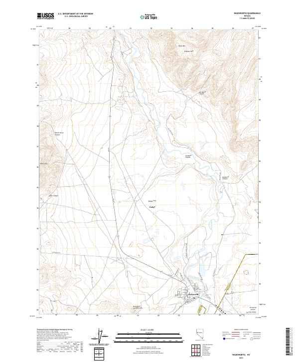
2021 Map of Wadsworth
USGS Topo · Published 2021About this map
The Truckee River carves through this corner of the Great Basin, where the historical settlement of Wadsworth serves as a focal point at the junction of modern and historic transit corridors. The street grid of the town, including Main St and Herman Ave, is clearly defined alongside the tracks of the railroad. To the north, the landscape transitions into the arid expanse of Dodge Flat and the edges of the notorious Fortymile Desert, a segment of the California Trail known for its harsh conditions. The terrain is marked by distinctive geological features such as the Diabase Hills, Black Mtn, and the curiously named Red White and Blue Mtn to the south. Local ranching and mining history is suggested by named canyons like Hill Ranch Canyon and Tiger Canyon, while the presence of the Lincoln Hwy highlights the area's long-standing role as a gateway for transcontinental travel.
Find a feature on this map
40 named features on this map. Tap any name to fly to it.
Don’t see what you’re looking for? This feature index may not catch every label — zoom into the map to look around manually.
Map Details
Editions of this 2021 Wadsworth Map
This is the sole edition of this map. No revisions or reprints were ever made.
Other maps of this area

1890 · Wadsworth
USGS Topo · 1:125,000

1892 · Wadsworth
USGS Topo · 1:125,000

1894 · Wadsworth
USGS Topo · 1:125,000

1957 · Fireball Ridge
USGS Topo · 1:62,500

1957 · Two Tips
USGS Topo · 1:62,500

1957 · Wadsworth
USGS Topo · 1:62,500

1957 · Nixon
USGS Topo · 1:62,500

1957 · Reno
USGS Topo · 1:250,000

1959 · Reno
USGS Topo · 1:250,000

1960 · Reno
USGS Topo · 1:250,000