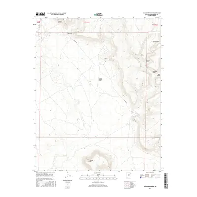
2017 Map of Waggoner Ranch
USGS Topo · Published 2017About this map
Waggoner Ranch sits within a landscape defined by dramatic relief and isolated ranching infrastructure in San Miguel County. This 2017 survey by the U.S. Geological Survey illustrates a high-desert environment where the flat expanse of Huerfano Mesa rises above a network of deep drainages. Transportation is limited to rugged tracks like Mule Creek Dr, which provides access to the remote Bell Ranch Waggoner Airport.
Find a feature on this map
16 named features on this map. Tap any name to fly to it.
Don’t see what you’re looking for? This feature index may not catch every label — zoom into the map to look around manually.
Map Details
Editions of this 2017 Waggoner Ranch Map
This is the sole edition of this map. No revisions or reprints were ever made.
Other maps of this area

1954 · Santa Fe
USGS Topo · 1:250,000

1954 · Tucumcari
USGS Topo · 1:250,000

1958 · Santa Fe
USGS Topo · 1:250,000

1958 · Tucumcari
USGS Topo · 1:250,000
1969 · Campana
USGS Topo · 1:24,000

1969 · Chinaberry Canyon
USGS Topo · 1:24,000
1972 · Bell Ranch
USGS Topo · 1:24,000

1972 · Montoya Point
USGS Topo · 1:24,000

1972 · Waggoner Ranch
USGS Topo · 1:24,000
1972 · Minese Mesa
USGS Topo · 1:24,000