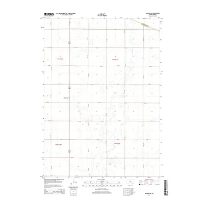
2015 Map of Wagner NE
USGS Topo · Published 2015About this map
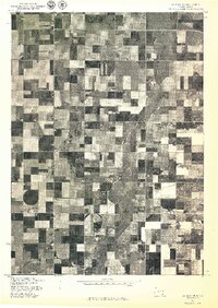
Choteau Creek winds through this rural landscape in Charles Mix County, South Dakota, defining the drainage patterns of the eastern plains. The terrain is structured by a precise grid of sections and section-line roads, such as 290th St and 393rd Ave, which reflect the enduring influence of the Public Land Survey System on the region's agricultural layout. Along the western edge of the map, the East Lake Andes Lutheran Cem serves as a significant landmark for family historians and genealogists, marking the site of a community focal point amidst the surrounding farmland. In the south-central portion of the quadrangle, Burks Lake provides a natural contrast to the cultivated fields, while the boundary with Douglas County clips the northern corner, indicating the map's position at a jurisdictional intersection.
Find a feature on this map
22 named features on this map. Tap any name to fly to it.
Don’t see what you’re looking for? This feature index may not catch every label — zoom into the map to look around manually.
Map Details
Editions of this 2015 Wagner NE Map
This is the sole edition of this map. No revisions or reprints were ever made.
Other maps of this area

1955 · Mitchell
USGS Topo · 1:250,000

1959 · Mitchell
USGS Topo · 1:250,000

1964 · Wagner NE
USGS Topo · 1:24,000

1964 · Ravinia
USGS Topo · 1:24,000

1964 · Wagner
USGS Topo · 1:24,000

1964 · Wagner SW
USGS Topo · 1:24,000
1972 · Dante
USGS Topo · 1:24,000
1977 · Wagner
USGS Topo · 1:24,000
1977 · Wagner SW
USGS Topo · 1:24,000
1977 · Wagner NE
USGS Topo · 1:24,000
Featured Places
- Howard Township, SD
- Plain Center Township, SD
- Independence Township, SD
- Kennedy Township, SD
- Bryan Township, SD