
1964 Map of Wagner NE
USGS Topo · Published 1965About this map
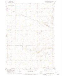
Choteau Creek meanders through this landscape on the boundary of Charles Mix and Douglas County, reflecting a rural settlement pattern defined by school districts and townships in the mid-1960s. The map highlights the Yankton Indian Res Bdy, which cuts across the northeast corner, marking a significant historical and jurisdictional boundary. The area is divided into named townships including Howard, Kennedy, Plain Center, and Bryan, each anchored by foundational community structures. Genealogists will find the East Lake Andes Ch Cem and numbered school sites such as School No 1, School No 2, and School No 3 particularly useful for locating family homesteads. The terrain is characterized by prairie potholes and small water bodies like Burks Lake, with local industry noted at a Gravel Pit near the center of the sheet.
Find a feature on this map
13 named features on this map. Tap any name to fly to it.
Don’t see what you’re looking for? This feature index may not catch every label — zoom into the map to look around manually.
Map Details
Editions of this 1964 Wagner NE Map
This is the sole edition of this map. No revisions or reprints were ever made.
Other maps of this area

1955 · Mitchell
USGS Topo · 1:250,000

1959 · Mitchell
USGS Topo · 1:250,000

1964 · Ravinia
USGS Topo · 1:24,000

1964 · Wagner
USGS Topo · 1:24,000

1964 · Wagner SW
USGS Topo · 1:24,000
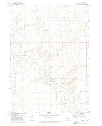
1972 · Dante
USGS Topo · 1:24,000
1977 · Wagner
USGS Topo · 1:24,000
1977 · Wagner SW
USGS Topo · 1:24,000
1977 · Wagner NE
USGS Topo · 1:24,000
1978 · Greenwood Colony
USGS Topo · 1:24,000
Featured Places
- Howard Township, SD
- Bryan Township, SD
- Kennedy Township, SD
- Plain Center Township, SD
- Independence Township, SD