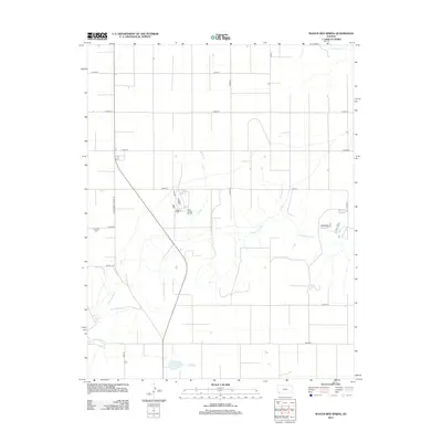
2012 Map of Wagon Bed Spring
USGS Topo · Published 2012About this map
Wagon Bed Spring anchors this portion of southwestern Kansas, a site historically significant for its role along the Cimarron Route. The landscape is defined by the winding course of the Cimarron River and the N Fk Cimarron R, which cut through a predominantly rural grid of agricultural roads. Local history is etched into the terrain at Zionville Cem, situated along S Wagonbed Springs Rd. The map illustrates a sparse settlement pattern characteristic of the High Plains, where the road network, including identifiers like 1 Mi Rd and Road Dd, dictates the modern geography around these ancient water sources. The transition from the river bottom to the surrounding plains is marked by a network of section roads that speak to the enduring surveyor's grid of the American West.
Find a feature on this map
20 named features on this map. Tap any name to fly to it.
Don’t see what you’re looking for? This feature index may not catch every label — zoom into the map to look around manually.
Map Details
Editions of this 2012 Wagon Bed Spring Map
This is the sole edition of this map. No revisions or reprints were ever made.
Other maps of this area

1891 · Larned
USGS Topo · 1:125,000

1900 · Lakin
USGS Topo · 1:125,000

1944 · Moscow
USGS Topo · 1:62,500

1945 · Moscow
USGS Topo · 1:62,500

1955 · Dodge City
USGS Topo · 1:250,000

1958 · Dodge City
USGS Topo · 1:250,000

1959 · Dodge City
USGS Topo · 1:250,000

1959 · Ulysses
USGS Topo · 1:24,000
1959 · Ulysses SW
USGS Topo · 1:24,000

1959 · Hickok
USGS Topo · 1:24,000