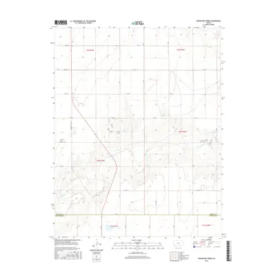
2016 Map of Wagon Bed Spring
USGS Topo · Published 2016About this map
The Cimarron River winds through the southwestern Kansas prairie, defining the landscape of Sullivan Township in this modern topographic study. This area is noted for Wagon Bed Spring, a landmark of deep historical significance along the river valley. The map details the transition from the high plains to the riverbed, marked by the intersection of S Wagonbed Springs Rd and Co Rd 10 S. Cultural and genealogical points of interest include the Zionville Cem situated north of the river. The southern portion of the map follows the straight administrative boundary of the Grant Co and Stevens Co line, crossed by the north-south axis of Rd Dd. This survey captures the sparse, rural nature of the region, where the primary infrastructure consists of a grid-like network of county roads supporting local agriculture and the management of water resources along the Cimarron.
Find a feature on this map
19 named features on this map. Tap any name to fly to it.
Don’t see what you’re looking for? This feature index may not catch every label — zoom into the map to look around manually.
Map Details
Editions of this 2016 Wagon Bed Spring Map
This is the sole edition of this map. No revisions or reprints were ever made.
Other maps of this area

1891 · Larned
USGS Topo · 1:125,000

1900 · Lakin
USGS Topo · 1:125,000

1944 · Moscow
USGS Topo · 1:62,500

1945 · Moscow
USGS Topo · 1:62,500

1955 · Dodge City
USGS Topo · 1:250,000

1958 · Dodge City
USGS Topo · 1:250,000

1959 · Dodge City
USGS Topo · 1:250,000

1959 · Ulysses
USGS Topo · 1:24,000
1959 · Ulysses SW
USGS Topo · 1:24,000

1959 · Hickok
USGS Topo · 1:24,000