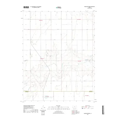
2018 Map of Wagon Bed Spring
USGS Topo · Published 2018About this map
Wagon Bed Spring serves as a focal point in this 2018 survey of the High Plains, marking a site of immense importance for early travelers along the Cimarron Route. The landscape is defined by the winding course of the Cimarron River, which cuts through the flat terrain near the border of Grant County and Stevens County. This arid region’s history is anchored by the presence of Zionville Cem, located along Co RD 10 S in the western half of the map. The sparse settlement pattern is tied to a grid of county roads, such as S Wagonbed Springs Rd and Co RD 18, which facilitate movement across the agricultural and ranching lands. This map captures the modern topography of a place where water sources like the spring once dictated the survival of pioneers and traders on the frontier.
Find a feature on this map
32 named features on this map. Tap any name to fly to it.
Don’t see what you’re looking for? This feature index may not catch every label — zoom into the map to look around manually.
Map Details
Editions of this 2018 Wagon Bed Spring Map
This is the sole edition of this map. No revisions or reprints were ever made.
Other maps of this area

1891 · Larned
USGS Topo · 1:125,000

1900 · Lakin
USGS Topo · 1:125,000

1944 · Moscow
USGS Topo · 1:62,500

1945 · Moscow
USGS Topo · 1:62,500

1955 · Dodge City
USGS Topo · 1:250,000

1958 · Dodge City
USGS Topo · 1:250,000

1959 · Dodge City
USGS Topo · 1:250,000

1959 · Ulysses
USGS Topo · 1:24,000
1959 · Ulysses SW
USGS Topo · 1:24,000

1959 · Hickok
USGS Topo · 1:24,000